Considering a road trip from Vancouver to Penticton? A great choice! This road trip promises a blend of contrasting scenic landscapes, characterful small towns, hiking opportunities and more.
The final destination is exciting too; an approachable city set between two lakes surrounded by sandy beaches, vineyards and mountains.
Living in Penticton, we make the journey between Vancouver and the Okanagan Valley at least four or five times a year. Needless to say, we are very familiar with this road trip.
In this post, I’ll share the best places to stop when driving from Vancouver to Penticton. I’ve covered both major routes – Highway 3 and Highway 5 – and also included an overview of our top picks for Penticton activities (and accommodation) as well.
Whether you’re visiting Penticton for a weekend or passing through on a longer road trip, I hope this post helps you plan the best journey possible!
Please contact individual businesses for the most accurate information. There may be affiliate links in this post. We may earn a small percentage of any resulting sales or bookings.
Vancouver to Penticton road trip overview
Before delving into the top places to explore on a Vancouver and Penticton road trip, let’s take a look at a route overview.
The drive from Vancouver to Penticton is around 400km and takes at least 4 hours and 30 minutes.
Leaving Vancouver, Highway 1 is the fastest way to travel east.
When approaching Hope (120km from Vancouver), drivers need to choose between Highway 3 and Highway 5.
Regardless of the route chosen, plan for your Vancouver to Penticton road trip to take approximately 6 to 7 hours, factoring in a few sightseeing stops and washroom breaks.
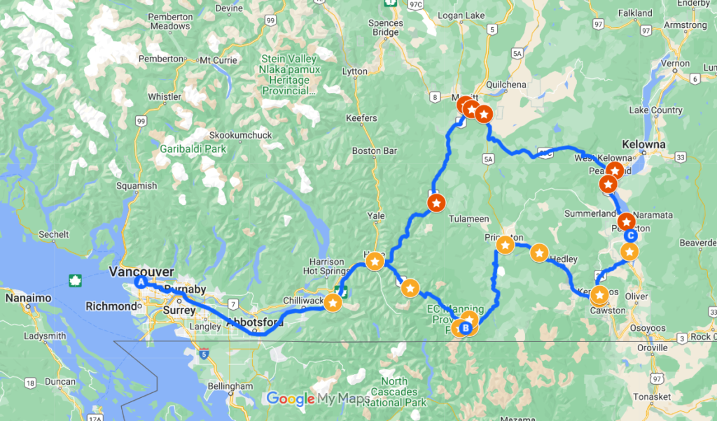
Highway 3
Referred to by Penticton locals as the ‘Manning route,’ Highway 3 travels through E.C. Manning Provincial Park. Surrounded by mountains, forest and grasslands, it is a remarkably scenic road.
Except for a few long flat sections, most of the drive is pretty winding, with a significant amount of elevation gain and loss. For the most part, the highway is two lane only with one lane in either direction. There are some passing sections.
There are very few communities along the journey, with Princeton being the most popular destination for gas and food.
Highway 3 splits in Keremeos, with the 3A route travelling northeast. It intersects Highway 97 near Skaha Lake, which leads north to Penticton.
Highway 5
The Hope to Merritt section of Highway 5 is known as the Coquihalla (or ‘the Coq,’ pronounced like ‘coke’).
With an annual snowfall of 11 metres, the Coquihalla has the reputation for being one of the most treacherous winter driving routes in all of North America (it is even the subject of a long running TV show!) The highest point on the Coq is 1244m.
Upon reaching Merritt, drivers on Highway 5 must then switch to Highway 97C, also known as the Okanagan Connector. This highway is the second highest in British Columbia (1728m). The 97C ends at a junction with Highway 97, which extends southwards Penticton.
Merritt is the main gas and food stop on the Highway 5 route. Peachland is another good place to get supplies, though it is pretty close to Penticton.
Highway 3 vs Highway 5
A quick time/distance comparison of the two Vancouver to Penticton driving routes would be:
- Highway 3 – 400km, around 4 hours 50 minutes
- Highway 5 – 420km, around 4 hours 30 minutes
Despite being longer, the Coquihalla route (Highway 5) is faster due to higher speed limits and double/triple lanes throughout. Highway 3 features sharp turns and most of the road is two-lane only (one lane in either direction).
If you dislike twisty roads and prefer driving on a wide highway, I would say that Highway 5 is probably the better option.
We alternate between these two routes often, depending on our schedule and the type of vehicle we’re driving. We find that we use more gas driving the Coquihalla, which can prove to be expensive.
The Coquihalla is also busier, especially with commercial truck traffic. That in combination with the highway being more vulnerable to bad weather, we usually avoid driving the Coquihalla in winter.
The Manning Park route (Highway 3) is slower but also quieter. I think the scenery is better, but that is quite subjective. We know people who think the Coquihalla is more impressive.
When considering the best things to do between Vancouver and Penticton, I think the Manning Park route has a better choice of activities.
If you’re returning to Vancouver, I would recommend driving one route there and the other route on the way back. Choose Highway 3 for the day you have more time to make stops.
Vancouver to Penticton road trip via Highway 3: The best places to stop
Time to start your road trip from Vancouver to Penticton! Grab your keys, pack essentials, fuel up, and set the GPS. Adventure awaits!
Vancouver to Hope
Leaving Vancouver, enjoy the views of the Cascade Mountains ahead on Highway 1. Mount Baker (3,288m) looms above.
Depending on your gas level, you might consider refuelling in Chilliwack. While Abbotsford typically offers the lowest gas prices in the Lower Mainland, we’ve found that gas stations in Chilliwack are often quicker and more convenient to access.
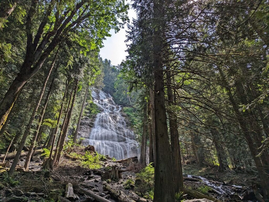
My first recommended stop is Bridal Veil Falls just west of Hope. This impressive 122m waterfall is located just off Highway 1. The short but steep uphill trail to the base of the impressive falls takes around 10-15 minutes to hike. Return the same way or take the loop path along the river.
Craving caffeine, snacks, or a meal? Explore the modern yet inviting ambience of Blue Moose Coffee House in Hope. Fun fact – Rambo was filmed in this small town surrounded by mountains.
Check your gas tank before leaving Hope. There is only one gas station between Hope and Princeton. There is also very little phone signal between these two towns.
Hope to Princeton
Roughly 15 minutes past Hope, the highway leads into E.C. Manning Provincial Park.
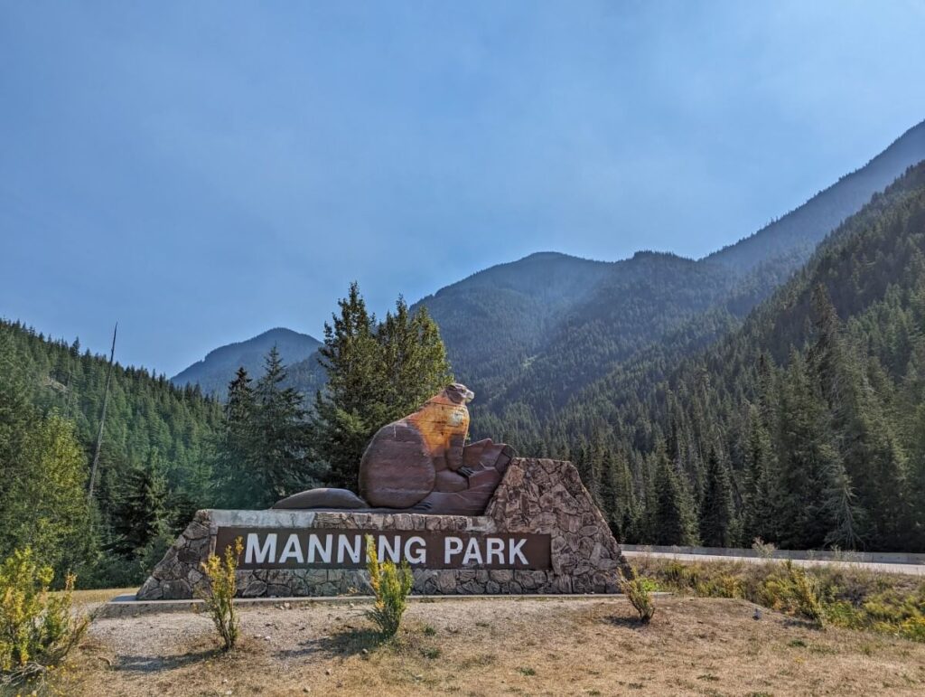
At the park’s western entrance, find a picnic area with outhouses alongside a large marmot statue. An alternative picnic spot would be Lightning Lake (further 47km, 10 minute detour).
Highway 3 traverses Manning Park for 60 kilometres. The route predominantly consists of two lanes (totalling four lanes), with occasional narrow, winding sections.
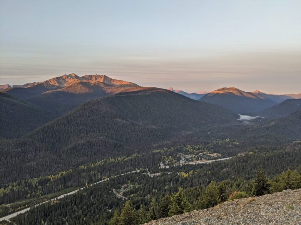
Driving between Vancouver and Penticton during the summer months? Drive up the paved 7.8km long Blackwall Road to the Cascade Lookout and enjoy the breathtaking valley and mountain vistas.
If you have more time (and your own vehicle, not a rental), I’d recommend continuing another 6km along the unpaved section of Blackwall Road to the alpine meadows. A carpet of vibrant wildflowers blooms here in late July and early August.
There is a wide range of fantastic hiking trails in Manning Park. If you need to stay overnight while driving between Vancouver and Penticton, Manning Park would be my top pick.
After Manning Park, the landscape undergoes a noticeable transition, becoming considerably drier with sparser trees. Ahead lie some of the highway’s sharpest turns and highest hills. Slow down and take those corners carefully.
Princeton to Penticton
Princeton serves as an excellent spot for refuelling or meal breaks. Enjoy reliable pub-style favourites at The Copper Pit. The modern Visitor Center has a friendly team of staff and excellent washroom facilities.
East of Princeton, Highway 3 closely follows the Similkameen River. A popular place for a swim is Bromley Rock Provincial Park. Some caution is required as the currents can be strong when the river is high in late spring and early summer.
There is a rest area 5km before Keremeos. This is a good spot to try and catch sight of the bighorn sheep on the surrounding mountains.
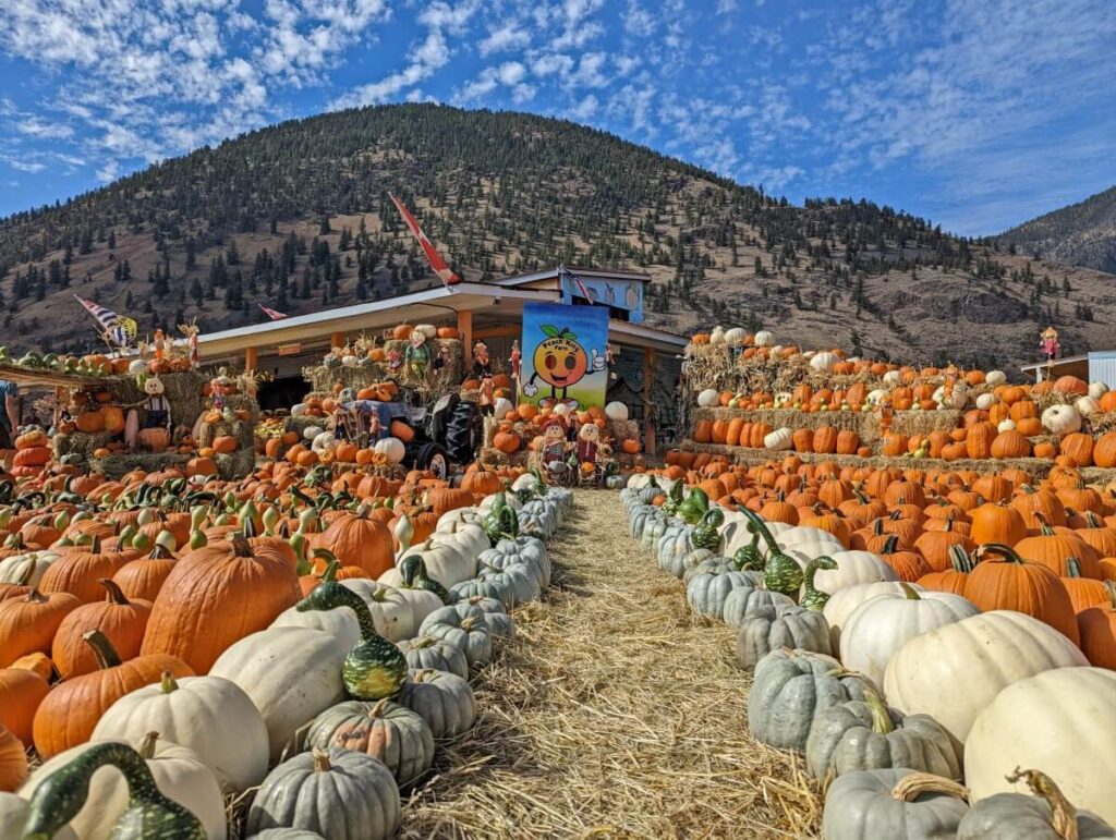
Keremeos is the fruit stand capital of British Columbia. The produce is consistently fresh and reasonably priced. While Peach King Orchards is our favourite stand, you can’t make a wrong choice here. Depending on the season, stock up on cherries, peaches, apricots, plums, apples and pumpkins.
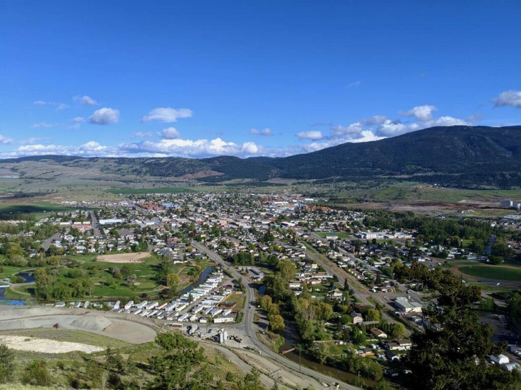
After Keremeos, Penticton-bound travellers should turn onto Highway 3A. This section of the journey is mostly flat, with a winding section near the end before the Highway 97 intersection. Head north and enjoy your first views of Penticton and Skaha Lake.
My last suggestion is to stop briefly at the Highway 97 viewpoint. It offers great views of the lake as well as Skaha Bluffs Provincial Park.
Vancouver to Penticton road trip via Highway 5: Where to stop
The first part of this journey is the same as the above Highway 3 road trip. After Hope, follow the signs to Highway 5. Be aware that there are no gas stations between Hope and Merritt, so it’s advisable to check your fuel level before departing.
Hope to Merritt
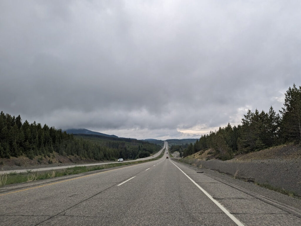
The start of Highway 5 stays close to the Coquihalla River, with glimpses of the rushing water visible to drivers. The road climbs continuously, with three-lane sections to help with overtaking large vehicles. There several long tunnels.
The best rest area is located at Britton Creek, 58km (40 minutes) from Hope. There are views of the surrounding forest and mountains.
Past the Coquihalla Summit Recreation Area, the foliage starts to change. The landscape is still mostly forest but it is noticeably drier. The highway straightens out and the Coldwater River parallels the road.
The small town of Merritt is located just a few kilometres away from the junction of Highway 5 and Highway 97C. Nestled in serene rolling grasslands, Merritt serves as a gateway to British Columbia’s expansive interior region.
Should you need food or gas, make a stop in Merritt. There are very few services for the next 105km.
Our top pick in Merritt is the Kekuli Café, a locally owned Indigenous cuisine restaurant. Tuck into the fresh yet filling Wild Salmon Taco bowl and pick up some homemade Saskatoon bannocks for the road.
Merritt to Peachland
Looking to search your legs around Merritt? Check out the 1.9km Godey Creek Trail, situated close to the old Visitor Center at the 97C junction. There is some development in the area and the trailhead has apparently been moved past the second cattlegrid.
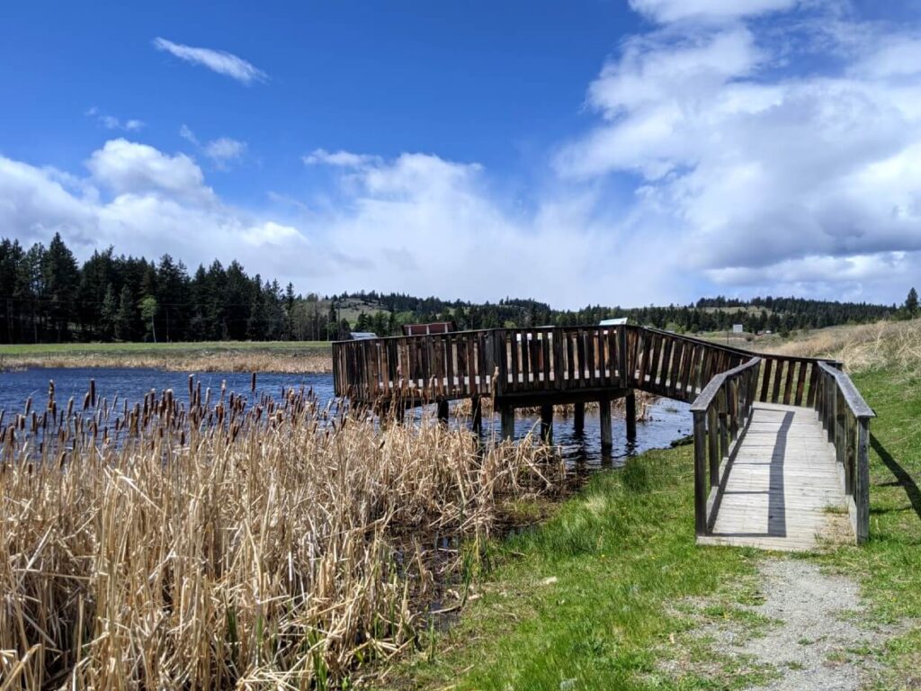
Another good option is the Laurie Guichon Memorial Grasslands Interpretive Site located close to the start of Highway 97C. There is an easy 750m long trail to a viewing platform over a pond. Washrooms are available in the parking area.
Ranked as BC’s second-highest highway, light snow is possible on the 97C even in May and October (we’ve seen it!) The journey includes a very long climb up to Pennask Summit, with a slow descent on the other side. There is a gas station at Elkhart.
The Inspiration Centre rest area offers your first view of the Okanagan Valley. At the end of the highway, head south on Highway 97.
Peachland to Penticton
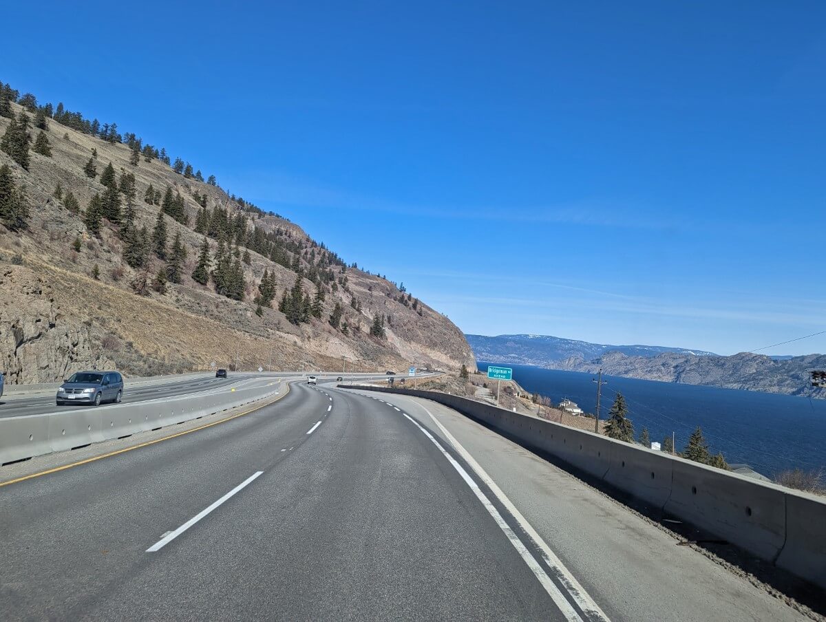
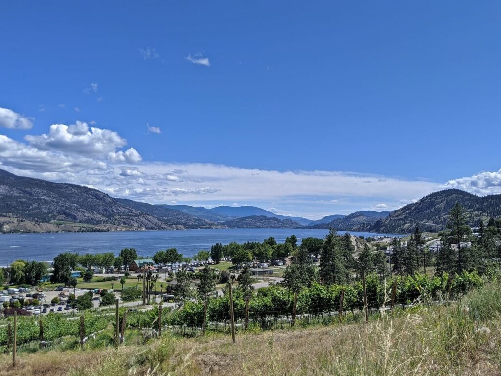
Picturesque Highway 97 follows the western shore of Okanagan Lake. The road can be very busy during the summer months, so prepare for a slower journey than you may expect. At the time of writing, there is significant construction between Peachland and Summerland.
If you have time for one final stop before arriving in Penticton, make the short detour to Hardy Falls. The 1.6km return walk through the canyon to the waterfall is completely flat. Salmon can be spotted in the river in September.
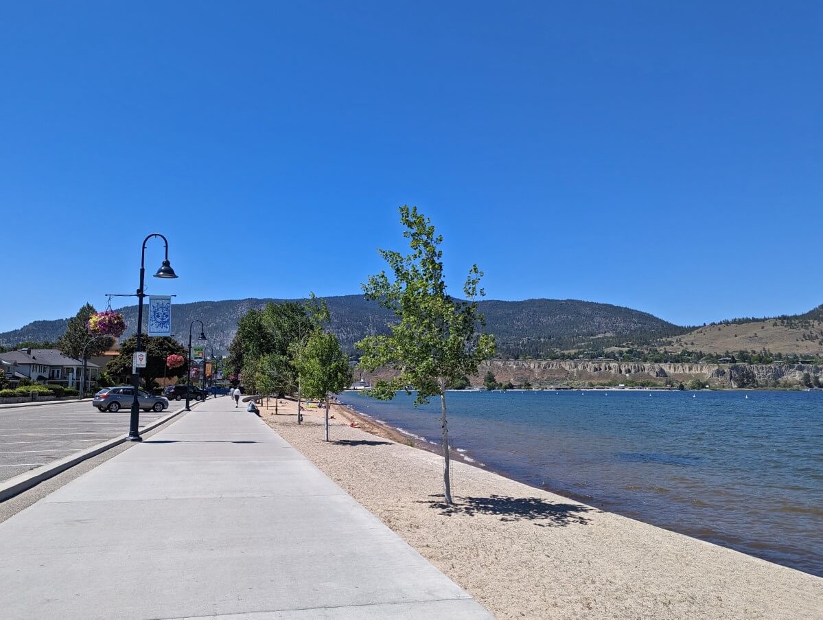
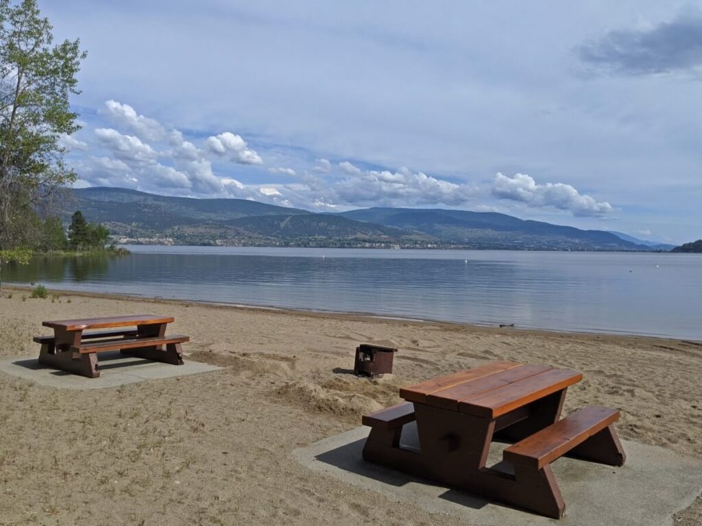
Another great place to visit along this section of Highway 97 is Sun-Oka Beach Park. The 500m long sandy beach is one of the best in the entire Okanagan Valley. There is a separate dog beach, so perhaps make this stop a priority if you have a furry friend with you.
Arriving in Penticton
Welcome to the Peach City! After your long Vancouver to Penticton drive, it’s time to relax. Or get active outdoors!
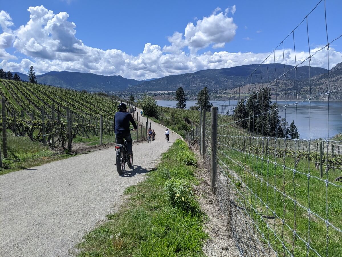
A trip to Penticton is all about doing as much or as little as you like, whether that involves wine tasting, relaxing on the beach, hiking, mountain biking or swimming in the lake.
As Penticton residents, our favourite local activities include:
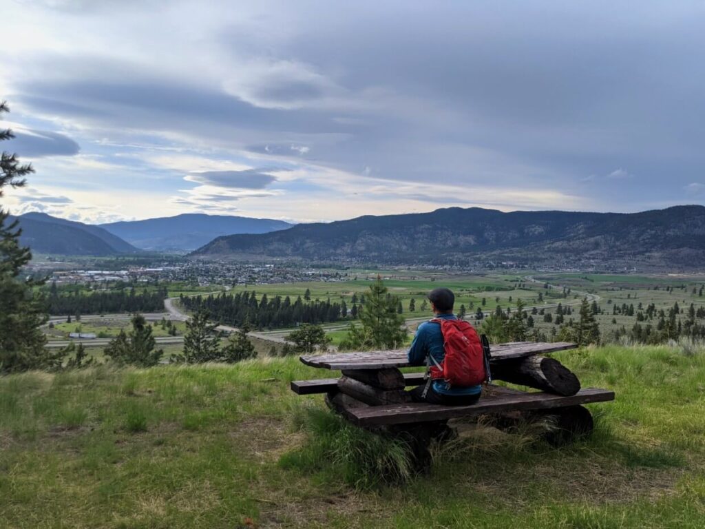
- Checking out the views from Munson Mountain
- Walking or biking the Kettle Valley Rail Trail through the vineyards
- Wine tasting on the Naramata Bench
- Floating the Okanagan River Channel
- Enjoying a picnic at one of many scenic spots
- Hiking to the Little Tunnel
- Chilling on the beach
- Exploring the excellent food scene
Check out this round-up of must do things to do in Penticton as well as our comprehensive list of free things to do. We also have a post showcasing the best things to do on the Naramata Bench.
Visiting for the weekend? We have a three day weekend itinerary for that too!
Where to stay in Penticton
Our top choice
The Lakeside Resort
In terms of location, it doesn’t get any better than this – the hotel sits right on the shores of Okanagan Lake, surrounded by municipal parks. Downtown Penticton is less than five minutes walk away.
Good value option
Tiki Shores
This motel is just one of a collection that lines the western end of Lakeshore Drive, just across the road from Okanagan Lake. There is a heated outdoor pool, BBQ area and on-site Asian fusion restaurant.
Quieter choice
Days Inn by Wyndham
This chain hotel provides comfortable accommodation in an advantageous location – less than 10 minutes away from Okanagan Lake, 2 minutes from the start of the River Channel Float
More great options (including campgrounds and vacation rentals) can be found in this dedicated Penticton accommodation post.