Host to some of the most impressive and easily accessible views of Penticton, Munson Mountain is a must stop for anyone visiting Penticton. It’s also the location of the iconic Penticton sign.
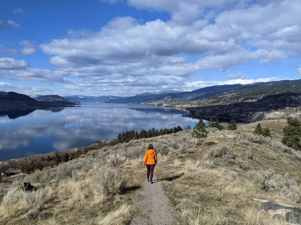
The short hike to the summit of this extinct volcano is short but exceptionally rewarding, with spectacular city, lake and valley views all the way along.
In this post, I’ll share everything you need to know about Munson Mountain in Penticton, including all the details on the hike to the top, some history and the best way to get there.
We live just down the road from Munson Mountain and visit it often. I love living so close to this beautiful viewpoint and make sure to bring all our visiting friends here.
There are affiliate links below. If you make a qualifying purchase via these links, we may receive a small percentage of the sale.
What is Munson Mountain?
Munson Mountain is a 496m high extinct volcano overlooking Penticton, British Columbia. It is less than 3km from the city’s downtown area and can be seen for miles around. Munson Mountain is particularly distinctive as it has large letters spelling out ‘Penticton’ on the side. More about that later.
While it may not look like volcano these days, Munson Mountain was pretty active during the Eocene period, about 55 to 34 million years ago.
Since then, rain, wind and glacial activity have drastically changed the look of the mountain.
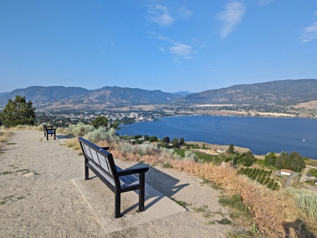
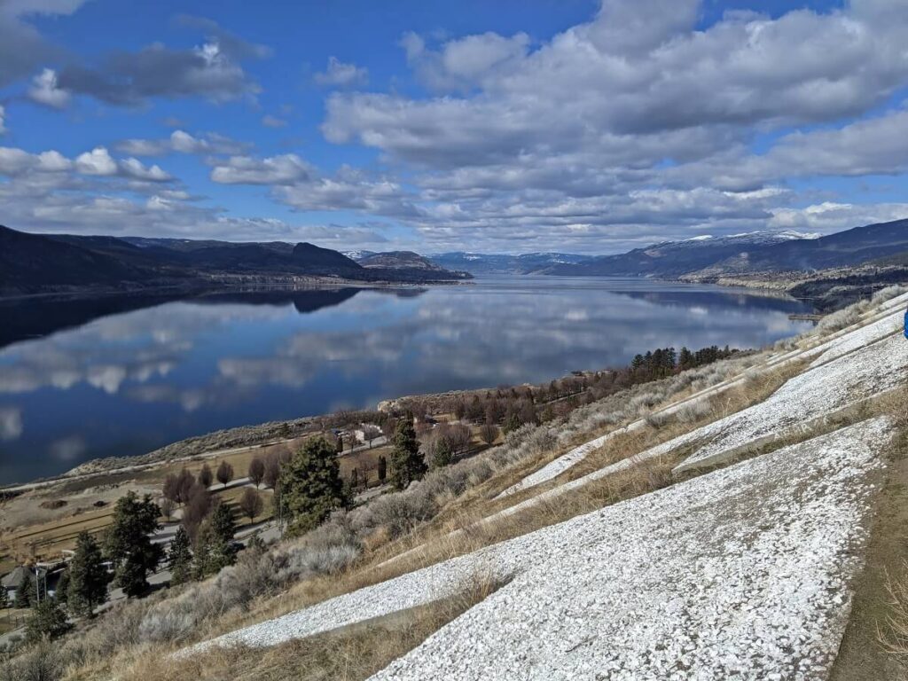
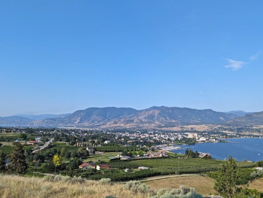
Nowadays, Munson Mountain is best known as a scenic viewpoint. And that it certainly is, with magnificent panoramas across the city of Penticton, Okanagan Lake, local vineyards, the KVR Trail, surrounding peaks and even Skaha Lake. Best of all, the views are free to enjoy and are accessible by people of all fitness levels.
Munson Mountain is one of Canada’s Historic Places.
What to expect at Munson Mountain
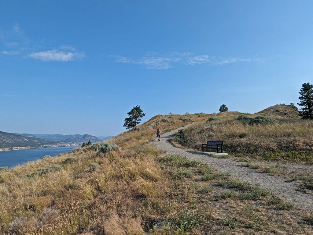
A short paved path from the parking area leads to viewpoint with a gazebo. A dirt trail leads from here up the ‘spine’ of the mountain to a flat plateau area.
Although the views are spectacular enough from the first viewpoint, they get even better higher up. The distance from the parking lot to the peak is 1km return.
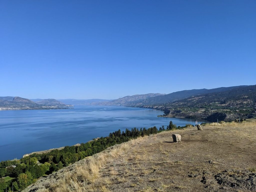
There are four large stones located on the summit of Munson Mountain. Two of them mark the sunset points on the Winter and Summer solstice, with the others marking the Spring and Fall equinoxes.
The Okanagan Centre of the Royal Astronomical Society of Canada holds gatherings at the top of Munson Mountain for the winter and summer solstices.
The Penticton sign
Since 1937, Munson Mountain has been host to the iconic Penticton sign. Undoubtedly inspired by the Hollywood sign, the Penticton version was designed to put the small town ‘on the map’. I would argue that is certainly still does, considering nowhere else in Canada has anything like it!
The Penticton sign consists of silica and concrete spelling out the word ‘Penticton’ on the side of the mountain. At 4.33 feet (16.5m) high and 308.39 feet (93.99m) wide, it is visible from the Okanagan Lake beaches along the north side of Penticton, as well as Highway 97. Personally, I love spotting the sign on our way home.
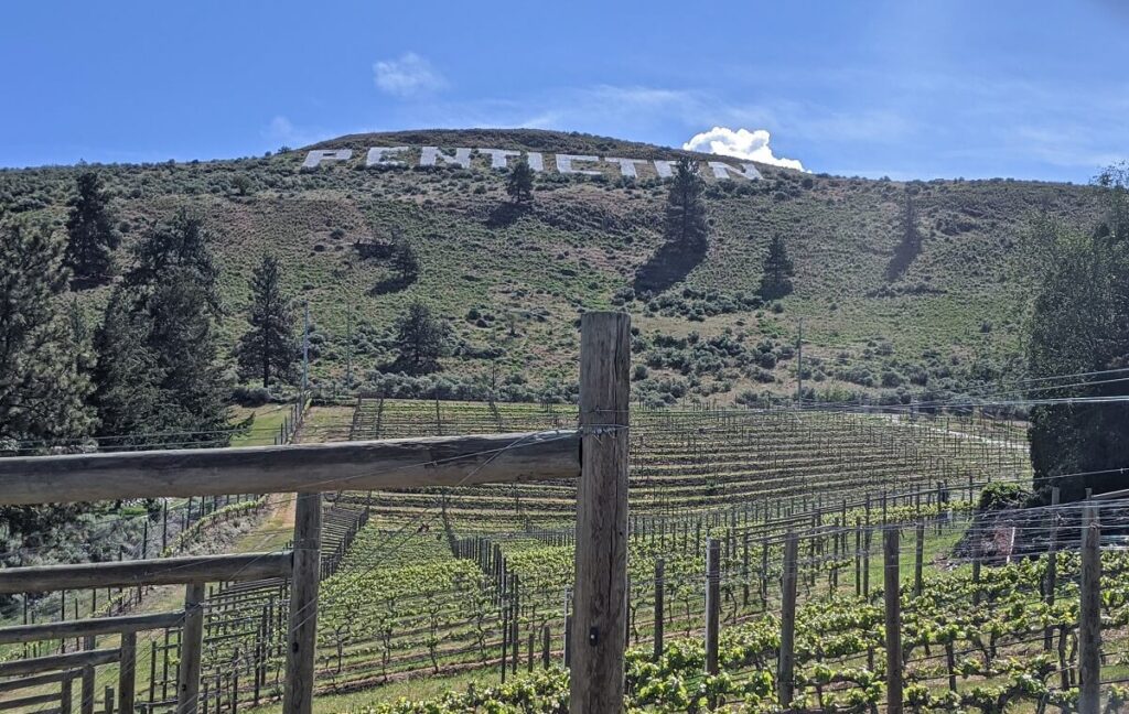
First constructed by the Board of Trade, it has been maintained by a myriad of volunteers over the years. The hauling of 44,000 pounds of silica rock to the site between 1972 and 1983 was a major project, with concrete later added in 1998. Volunteer groups continue to maintain the sign today (thank you!)
Hiking Munson Mountain offers the chance to see the Penticton sign close-up. A short side trail from the main route to the summit leads right to the side of the giant letters. This view may not be for everyone, however, as there is no safety barrier and perspective can be a little vertigo inducing!
Munson Mountain hike
The ‘hike’ to the summit of Munson Mountain is definitely more of a short, uphill walk. It is 1km round trip, with 25m elevation gain.
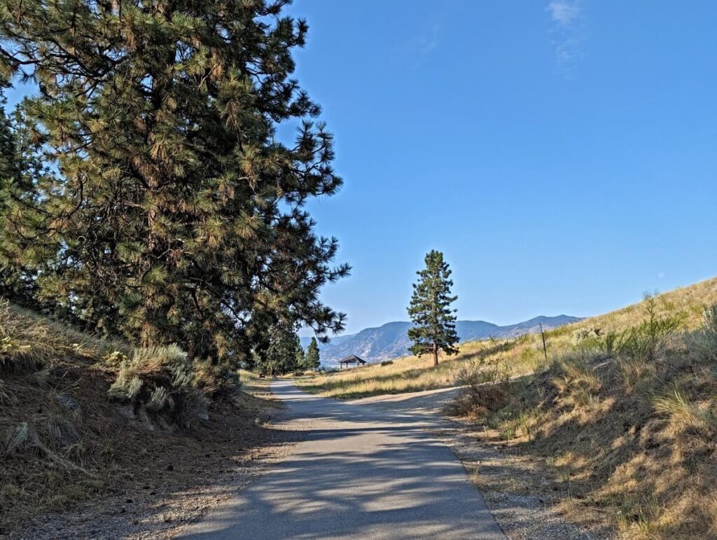
Access to the first viewpoint is paved and completely flat. It is therefore both wheelchair and stroller friendly. From the parking lot, walk towards the gazebo.
From the gazebo, the path turns to dirt as it travels up the ‘spine’ of the mountain. There is a steady uphill gradient. There are half a dozen benches located on the left hand side as the path climbs.
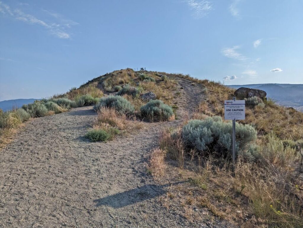
170m from the gazebo (about 3-4 minutes walk), the paved path disappears and a wide but steep gravel path leads steeply upwards. A small, narrow side trail detours to the top of the Penticton sign letters while the main route travels to a plateau above it.
There are some loose rocks on this section, something that you will probably notice on the way down rather than up. A few minutes later, you’ll arrive on the plateau at the summit. This area is deceivably large; there is plenty of space even if a few other groups are there as well.
After taking in the views, look for the four “Pen Henge’ stones as mentioned above.
If you’re feeling adventurous, consider walking down the other side of the summit. It is also steep, so be sure to watch your step. This downhill section is a great place to take photos if the main plateau area does happen to be busy. Eventually, this side transitions into private property so don’t go too far.
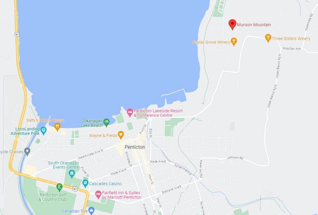
How to get to Munson Mountain
Munson Mountain is less than 10 minutes drive from downtown Penticton. Navigate to Middle Bench Road North. Go past Poplar Grove Winery. Turn left on the corner with Munson Avenue onto Munson Mountain Road – note the ‘Munson Mountain Scenic Lookout’ sign on the left hand side of the road.
Stay left at the almost immediate split in the road. This road is very narrow for 200m before arriving at the parking lot.
The parking area is not remarkably big, with space for 16 regular sized vehicles. While it can get busy, most people do not stay very long (I would estimate 20-30 minutes max), so the turnover is pretty high.
Essential info: Munson Mountain, Penticton
- If you want to go to the very top of Munson Mountain, I would highly recommend actual shoes over flipflops. If you don’t have runners or hikers with you, I’d suggest just going to the first viewpoint (at the gazebo) and then perhaps a little further up the dirt trail
- It is completely free to visit Munson Mountain with no admission fee or parking charge
- Munson Mountain is open all year round
- There are no facilities at Munson Mountain besides the parking lot, benches, trash bins and gazebo. The nearest public washroom is at Three Mile Beach (outhouse, 5 minute drive) or in Penticton
- If a thunderstorm is imminent, I would avoid visiting Munson Mountain as it is very exposed
- Besides the gazebo, there is zero shade on Munson Mountain. Bring a sun hat, sunscreen and water on hot days or visit prior to 10am during the summer months
- The dirt area between the parking lot and the gazebo can get very icy in winter. Black ice forms here, which is very hard to see. Wear microspikes or another type of traction device
- It is possible to get married on Munson Mountain. Apply for a permit via the City of Penticton
- Looking for a longer hike in the Penticton area? Check out the Little Tunnel hike or Naramata Creek Falls


9 thoughts on “Munson Mountain Viewpoint, Penticton: Complete Guide”
Comments are closed.