Hoping to check out some South Okanagan waterfalls? This post showcases three impressive waterfalls in the South Okanagan region of British Columbia. All trailheads are located within 45 minutes drive of Penticton.
Each cascade is unique, with all three offering varying experiences. One is very easy to access, with a wheelchair/stroller-friendly path. Another has a ‘hidden’ feel, with the surrounding forested canyon maintaining the secret. The third offers a rugged hiking experience in an off-the-beaten-track location.
Before getting into this South Okanagan waterfall guide, I thought it was worth mentioning Okanagan Falls. I was a bit disappointed the first time we visited! Despite the name, there are unfortunately no waterfalls in this small Okanagan Valley community.
While Okanagan Falls was named after a set of falls at the outlet of Skaha Lake, these were destroyed when a dam was constructed on the Okanagan River in the 1950s to regulate water levels.
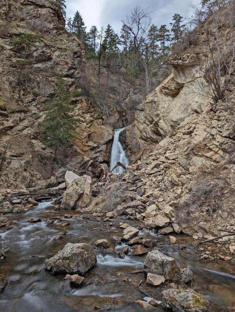
Naramata Creek Falls, Naramata
Length: 2.5km return, allow 1 to 1.5 hours
Difficulty: Easy with some harder sections (see below for details)
Trailhead location: Just off Naramata Road, Naramata
Parking: Small dedicated parking lot
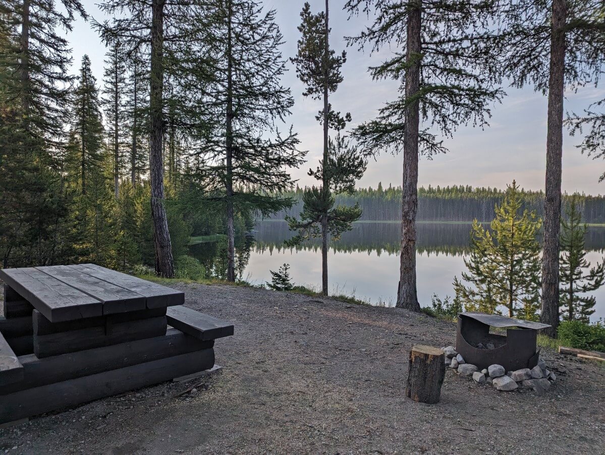
Facilities: Outhouse at trailhead, picnic table
More information: Naramata Creek Falls hiking guide
Naramata Creek Falls is a spectacular multi-level cascade set into a forested canyon near the village of Naramata. The shady setting means that it is a favoured destination in late spring and summer when the rest of the Valley is so hot!
This waterfall is something of a hidden gem as it is, quite literally, concealed just beyond the busy Naramata Road. Many Penticton locals are not aware of it.
The Naramata Creek Falls hike is low to medium difficulty. While it is only 2.5km return, the final approach to the waterfall is a little tricky. This is particularly true in spring when the cascade’s water flow is strongest and highest.
The hike begins with a very flat well maintained path through the forest. At the 1km mark, the trail enters the Nature Trust Conservation Area and the hike experience significantly changes. Choose to continue on a narrow uphill trail or stay along the creek. The latter requires two short creek crossings (no bridges).
Depending on the time of year, these creek crossings can be easy or difficult, sometimes even dangerous. When the water level is low, you can usually rock hop across and avoid getting wet feet.
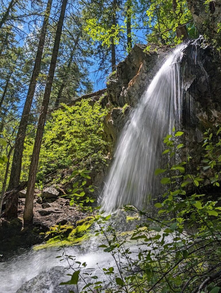
Hardy Falls, Peachland
Length: 0.8km return, allow 20-30 minutes
Difficulty: Very easy
Parking: Dedicated street parking opposite the trailhead
Trailhead location: Hardy Street, Peachland
Facilities: Interpretive signage, viewing platform
While it may be pushing the boundaries of the ‘South Okanagan,’ Hardy Falls is a beautiful canyon waterfall. The shaded trail follows the rushing Deep Creek over multiple bridges to the small cascade. The walls of the canyon are quite steep.
Hardy Falls is, without a doubt, the most accessible waterfall in the South Okanagan region. The trailhead is located just off Highway 97 to the south of Peachland.
The 400m long path to the waterfall is both short and flat. This means that Hardy Falls is accessible to families and people of all abilities. I would say that it is both stroller and wheelchair friendly.
The best time to visit is in late spring (May, June) when Hardy Falls is at peak flow. Another great time to visit is autumn when the bright red Kokanee salmon return to the creek to spawn.
Deep Creek is an important habitat for the Kokanee – be sure to stay out of the creek from September to May to avoid disturbing fish and eggs. One step could kill hundreds of salmon!
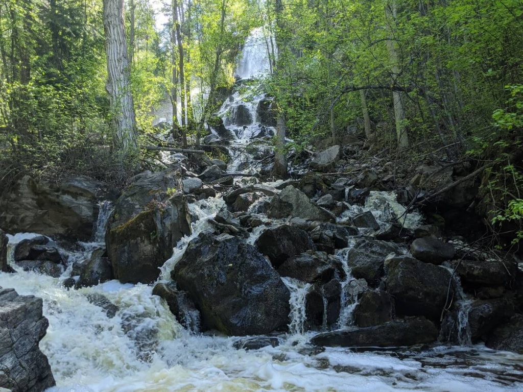
Barcelo Falls, Cawston
Length: 8km return, allow 2.5 to 3 hours
Difficulty: Moderate – 400m elevation gain, almost continual uphill to the falls
Parking: Street parking outside the trailhead
Trailhead location: Daly Drive, Cawston
Facilities: None
While Cawston is part of the Similkameen Valley rather than the Okanagan Valley, I have included this waterfall as it is an easy drive from most South Okanagan communities. Since there are not many waterfalls in the South Okanagan region, Barcelo Falls is a welcome addition to this list.
Barcelo Falls is situated on Manuel Creek, a rushing waterway that accompanies hikers for the length of the trail. It is necessary to cross the river around half a dozen times on the way, a feat that is much easier when the water flow is low (expect to rock hop).
The waterfall bursts out from the top of a rocky crag and makes its way through a pile of rocks to a viewing area. It is possible to climb up to the side of the main cascade and even underneath it (caution required).
The trail to Barcelo Falls starts on private land so be sure to stay on the path (I recommend utilising AllTrails) and be careful where you park. There is a large fence at the trailhead with a ‘no hunting’ notice.
Follow the defined route across the field and you’ll soon hear the creek. Follow the creek upstream. The trail often switches sides of the river and sometimes splits, with a high and low route. The higher routes have steep and narrow sections, with some loose rock.
We saw a bear and rattlesnake on our last trip, so stay aware of your surroundings!
1 thought on “The Best South Okanagan Waterfalls”
Comments are closed.